I am uniquely talented and experienced in conveying information visually. Below are some recent examples of mapping exhibits I have created to illustrate information to clients, county engineering agencies, and the public in general when needed. Feel free to check them out!
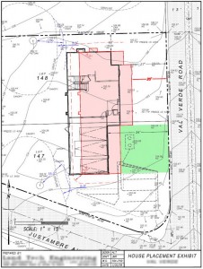 -click for lager view- House Placement Exhibit
This study was sent to the client to clearly show how the house footprint will need to be relocated based on county regulations regarding distance from existing oak trees on the project site. Distances are set to both the trunk of the tree and the dripline so both restrictions need to be shown as well as how the new house footprint will compare to the original location. |
|
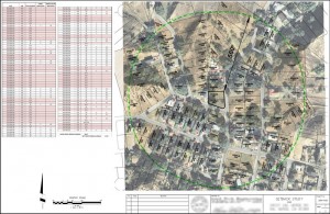 -click for lager view- Existing Setback Exhibit
This study was intended to illustrate the existing setback distances of all houses within a 500′ radius from the property in question. Distances were obtained from an ortho-rectified aerial photo and added to a table to determine the average setback distances. |
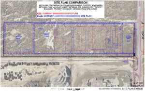 -click for lager view-
Here was a plan that I created to illustrate several things: I needed to show how this project was located in comparison to the adjacent existing property, also I wanted to illustrate the differences between to current drawings that had been prepared by two different engineering agencies. The different colors helped convey that information. |
|
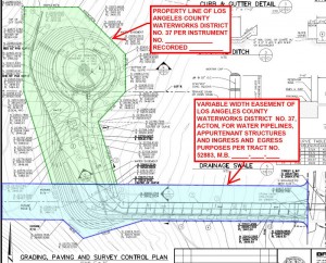 -click for lager view-
Here is a small map created and sent to the county for a clearer understanding of where the property lines of the affected waterworks district and the related easements are located. |
–click for larger image– |
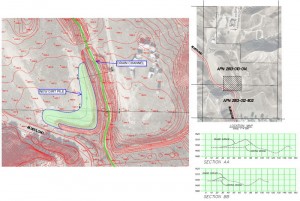
Graded Berm Exhibit
This exhibit was made to convey to county engineers approving a remedial grading plan to better help them understand the situation. There was an existing berm and drainage channel and the additional earthwork that was added to the berm has no affect on the drainage. Multiple cross-sections and color coding helped show the condition. |
|
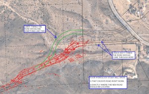
Roadway Design Comparisons
I created this exhibit to convey two differing design concepts regarding a roadway design. I made this plan using aerial photography, scanned design sketches, and line drawings and notes created with Adobe Acrobat. |
–click for larger image– |
–click for larger image– |
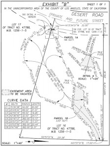
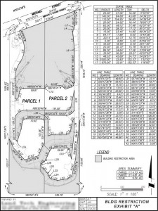
Easement Exhibits
Here are a couple of examples of easement exhibits I’ve created. These usually need to fit on a standard 8.5×11 sheet of paper so it is essential to make the most efficient use of space on the page. |
–click for larger image– |
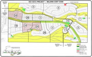
Project Cost Codes Exhibit
This exhibit was created at the direction of the client to illustrate graphically the different cost codes of an upcoming housing tract development. |
–click for larger image– |


